MYSTERY OF THE MISSING MIGRANTS | © Charley Harper Art Studio
BirdCast


Showcasing the spectacle of bird migration
When, where, and how far will birds migrate? How many birds passed last night? BirdCast helps you explore the answers to these and many other questions about bird migration.
Local bird migration alerts
Use BirdCast’s Local Migration Alert Tool HERE to determine whether birds are passing overhead near your city tonight!
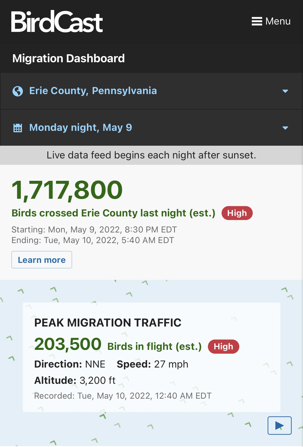
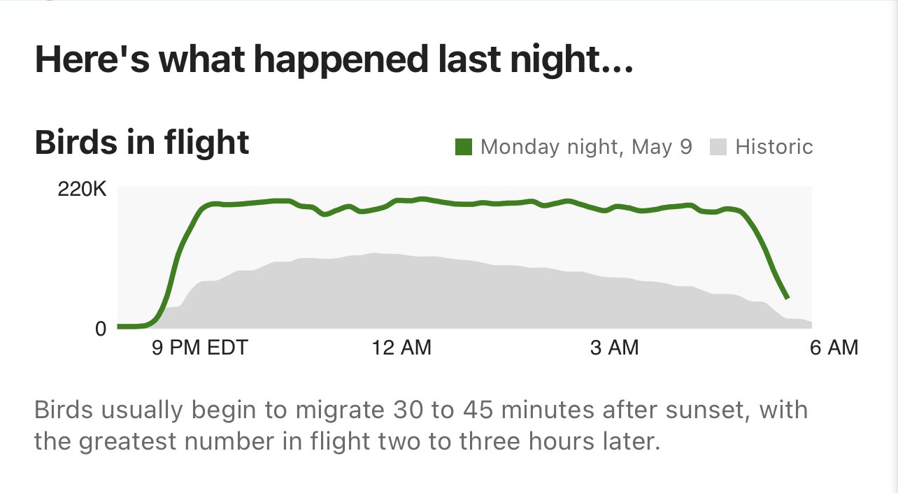
Migration Dashboard
Explore nightly migration data in your region HERE.
Bird migration forecast maps
Bird migration forecast maps show predicted nocturnal migration 3 hours after local sunset and are updated every 6 hours. Colorado State University and the Cornell Lab of Ornithology currently produce these forecasts. More info can be found HERE
Birding By Radar
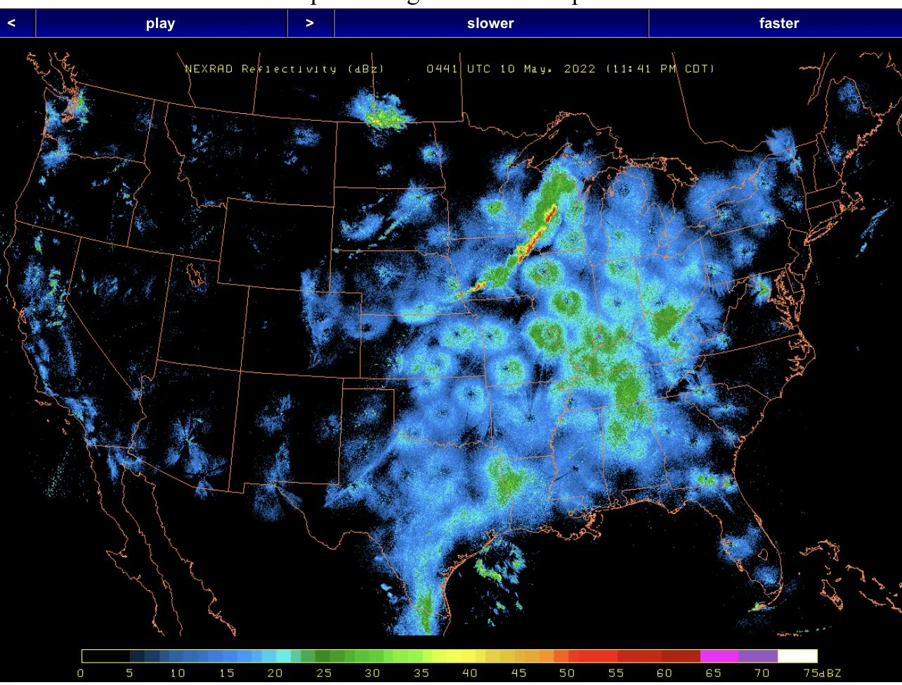
US Composite Radar Maps: A tool for observing bird migration
Content archived from the NEXRAD Radar page run by the Department of Atmospheric and Oceanic Sciences at the University of Wisconsin-Madison. The wind maps are from Weather Underground.
NEXRAD maps are archived every 10 minutes (expect a few to be missing).
Each 24 hour period spans 3pm ET on the stated date to 3pm the next day.
Permanent Link for current day (6pm-6pm EDT): http://www.pauljhurtado.com/US_Composite_Radar/recent.html


